Just this week, our new paper on “Mapping an archaeological site: Interpreting portable X-ray fluorescence (pXRF) soil analysis at Boroughgate, Skelton, UK” was published! And so, we thought it would be nice to share some of the work that went toward this with you all.
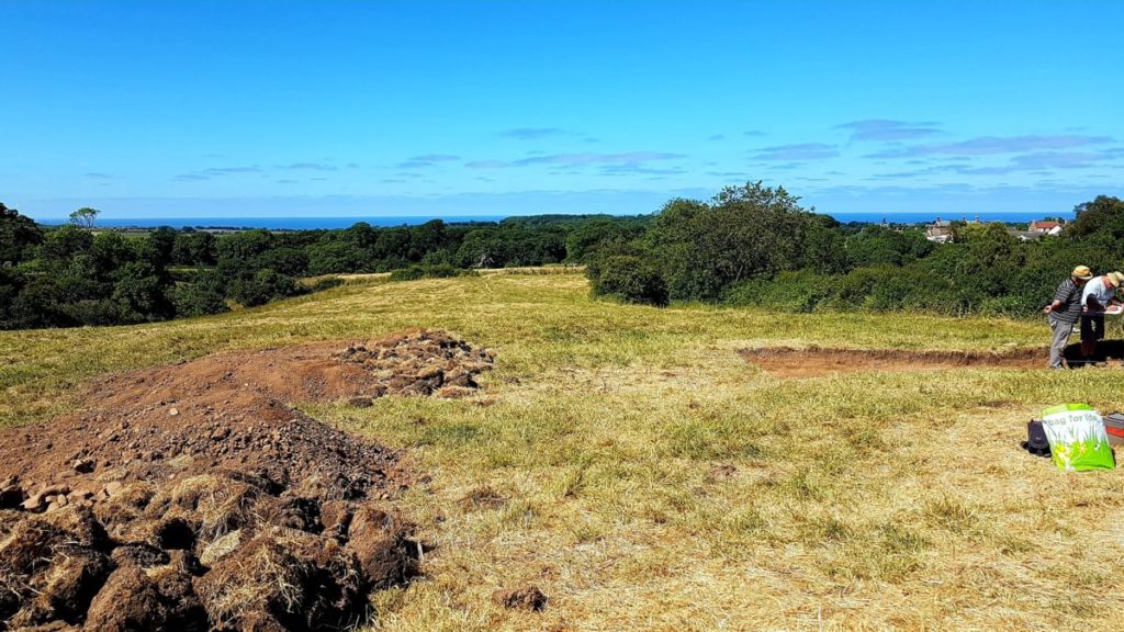
Boroughgate was a 12th Century medieval borough in Skelton, North Yorkshire UK, near the All Saint’s Old Church and Skelton Castle. It was placed in the perfect location to support trade and income for the castle via but unfortunately it was unsuccessful and abandoned around 1400 CE. The remnants of earthworks at the site and medieval documentation recording some of the tradespersons at Boroughgate gave some clues as to the history of the site. Tees Archaeology went through a series of surveys before excavating the site, inviting us out to complete some pXRF analysis and explore whether pXRF elemental analysis can enhance and support their interpretations of the site. This was also an excellent opportunity for us to show the value of our method development for pXRF soil analysis in archaeology! Admittedly, this also may have been a bit of an excuse to get out on such a glorious Summers day…
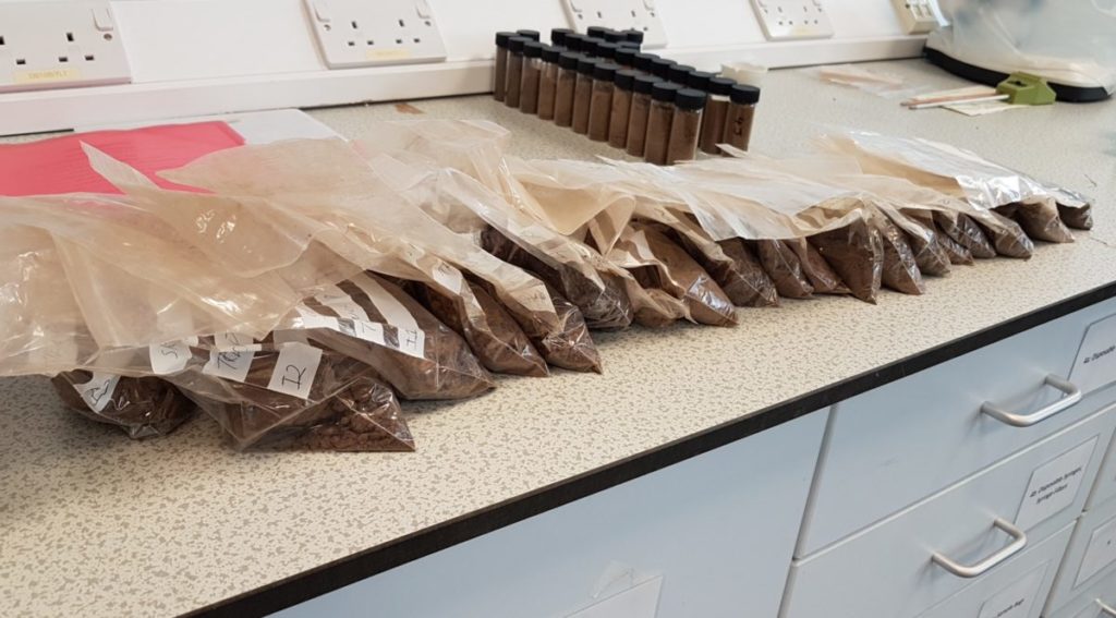
pXRF is often seen as a rapid point-and-shoot method but for good quality data, we really need an appropriate methodology. The soil matrix can vary greatly over just short distances, and we need to make sure that all our soil is examined in the same way, otherwise our comparisons are inconsistent and not well validated. We extract soil samples, dry them in the lab (preferably oven dried), grind down and sieve the samples so they’re nice and homogenous, and prepare them into pXRF sample cups. This does of course mean that we end up with a fair bit of soil samples in the lab from just one small area of soil..!
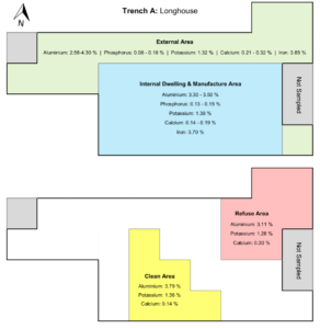
Research into social organisation and the activities or use of space from archaeological excavations uncover hidden knowledge on past societal practices and the structuring of historic communities. This work explored whether we could map out the elemental distribution of soil to identify different activity areas. This is discussed in much more detail in the journal article but just briefly, the distribution of aluminium, phosphorus, potassium calcium and iron distinguished between the internal dwelling and external area of a longhouse. Aluminium, potassium and calcium also distinguished a likely clean or food preparation area against a refuse area. These areas also aligned closely with the locations of artefacts such as pottery fragments, daub, and domestic or charred waste, as well as structural remains such as building foundation pads, postholes and wall foundations.
This was a well worthwhile investigation into mapping pXRF of soil which we’re very excited to continue further. Don’t hesitate to contact us if you’re interested in surveying your site with pXRF, we’d love to see how much more we can learn about past communities with pXRF! Now before you go, don’t forget to say hi to the ridiculously sweet kitten which I’ve dubbed Sandy the Archaeology Cat because of its love for sitting in soil buckets and climbing over your shoulders judging your use of the Harris Matrix:
And finally, thanks to David Errickson at Cranfield University, and Tees Archaeology for inviting us out to your site!
TUBA